
1963 Map of Pierce SE
USGS Topo · Published 1964About this map
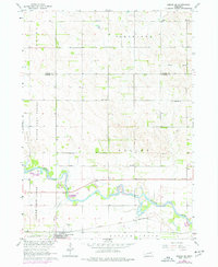
The Elkhorn River meanders across the southern plains of this 1963 Nebraska landscape, creating a fertile river bottom that anchors the region's rural development. The town of Battle Creek serves as a primary hub, situated near the Chicago and North Western rail line and the historic St Patricks Cem. This era reveals a remarkably dense network of rural one-room schoolhouses, including Born Sch, Dederman Sch, and Ray Sch, which were once the social and educational heart of the surrounding farmsteads. The topography shifts from the broad Cleveland Valley to the northern highlands, drained by North Deer Creek and South Deer Creek. This survey captures the transition of the Nebraska prairie into a highly organized agricultural grid, punctuated by local landmarks like Dry Hollow Sch and Best Sch.
Find a feature on this map
23 named features on this map. Tap any name to fly to it.
Don’t see what you’re looking for? This feature index may not catch every label — zoom into the map to look around manually.
Map Details
Editions of this 1963 Pierce SE Map
2 editions found
Other maps of this area

1955 · Sioux City
USGS Topo · 1:250,000

1955 · Fremont
USGS Topo · 1:250,000

1957 · Fremont
USGS Topo · 1:250,000

1958 · Sioux City
USGS Topo · 1:250,000

1958 · Fremont
USGS Topo · 1:250,000

1959 · Sioux City
USGS Topo · 1:250,000

1963 · Pierce NW
USGS Topo · 1:24,000

1963 · Battle Creek
USGS Topo · 1:24,000

1963 · Emerick
USGS Topo · 1:24,000

1963 · Meadow Grove
USGS Topo · 1:24,000