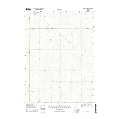
2014 Map of Randolph South
USGS Topo · Published 2014About this map
Randolph anchors the northern edge of this agricultural landscape in the 2010s, where the street grid of S Main St and S Douglas St meets a vast network of section-line roads. The terrain is defined by a system of drainage including Dog Cr, Deer Cr, and Baker Cr, which carve through the farmland of Northeast Nebraska. Further south, the small settlement of Sholes sits along Randolph St, illustrating the dispersed rural community structure of the region. This survey captures a moment where three counties — Pierce, Cedar, and Wayne — converge, reflecting the complex local jurisdictional boundaries that have shaped the land's ownership and development patterns for generations.
Find a feature on this map
28 named features on this map. Tap any name to fly to it.
Don’t see what you’re looking for? This feature index may not catch every label — zoom into the map to look around manually.
Map Details
Editions of this 2014 Randolph South Map
This is the sole edition of this map. No revisions or reprints were ever made.
Other maps of this area

1955 · Sioux City
USGS Topo · 1:250,000

1958 · Sioux City
USGS Topo · 1:250,000

1959 · Sioux City
USGS Topo · 1:250,000

1963 · Winside
USGS Topo · 1:24,000

1963 · Wee Town
USGS Topo · 1:24,000

1963 · Norfolk NE
USGS Topo · 1:24,000

1971 · Belden
USGS Topo · 1:24,000

1971 · Randolph South
USGS Topo · 1:24,000

1971 · Randolph North
USGS Topo · 1:24,000
1971 · Randolph SW
USGS Topo · 1:24,000