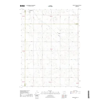
2017 Map of Randolph South
USGS Topo · Published 2017About this map
Randolph anchors the northern edge of this agricultural landscape at the convergence of Cedar and Pierce Counties. The settlement pattern follows a rigorous section line grid, with the township and range boundaries of t28n r1w and t28n r1e meeting just south of the town center. Local commerce and travel are defined by the intersection of S Main St and S Douglas St, while the broader region is connected by Hwy 98 at the southern boundary.
Find a feature on this map
36 named features on this map. Tap any name to fly to it.
Don’t see what you’re looking for? This feature index may not catch every label — zoom into the map to look around manually.
Map Details
Editions of this 2017 Randolph South Map
This is the sole edition of this map. No revisions or reprints were ever made.
Other maps of this area

1955 · Sioux City
USGS Topo · 1:250,000

1958 · Sioux City
USGS Topo · 1:250,000

1959 · Sioux City
USGS Topo · 1:250,000

1963 · Winside
USGS Topo · 1:24,000

1963 · Wee Town
USGS Topo · 1:24,000

1963 · Norfolk NE
USGS Topo · 1:24,000

1971 · Belden
USGS Topo · 1:24,000

1971 · Randolph South
USGS Topo · 1:24,000

1971 · Randolph North
USGS Topo · 1:24,000
1971 · Randolph SW
USGS Topo · 1:24,000