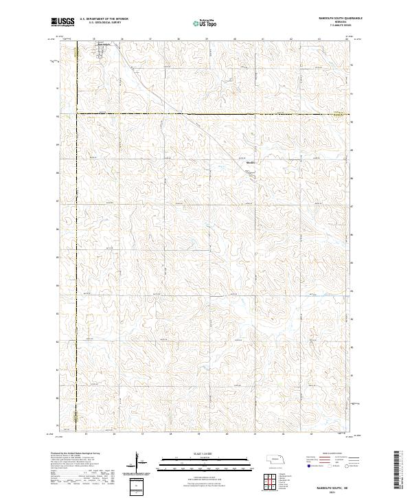
2021 Map of Randolph South
USGS Topo · Published 2021About this map
The agricultural landscape of northeast Nebraska is defined by a dense grid of section roads and the southern expansion of Randolph. This survey captures the transition between Pierce, Cedar, and Wayne Counties, where the terrain is dissected by the tributaries of Baker Cr, Dog Cr, and Deer Cr. The small community of Sholes serves as a local landmark along Sholes Rd, situated within a patchwork of family farmsteads typical of the region's rural character. A systematic network of avenues and numbered roads, such as 864th Rd and 561st Ave, illustrates the persistence of the Public Land Survey System. Modern infrastructure is anchored by Hwy 98 at the southern edge, providing a primary east-west artery through this productive corner of the Nebraska plains.
Find a feature on this map
37 named features on this map. Tap any name to fly to it.
Don’t see what you’re looking for? This feature index may not catch every label — zoom into the map to look around manually.
Map Details
Editions of this 2021 Randolph South Map
This is the sole edition of this map. No revisions or reprints were ever made.
Other maps of this area

1955 · Sioux City
USGS Topo · 1:250,000

1958 · Sioux City
USGS Topo · 1:250,000

1959 · Sioux City
USGS Topo · 1:250,000

1963 · Winside
USGS Topo · 1:24,000

1963 · Wee Town
USGS Topo · 1:24,000

1963 · Norfolk NE
USGS Topo · 1:24,000

1971 · Belden
USGS Topo · 1:24,000

1971 · Randolph South
USGS Topo · 1:24,000

1971 · Randolph North
USGS Topo · 1:24,000
1971 · Randolph SW
USGS Topo · 1:24,000