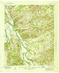
1939 Map of Rankin
USGS Topo · Published 1939About this map
The French Broad River and Nolichucky River converge in this 1939 Tennessee Valley Authority survey, illustrating a landscape defined by its fertile bottoms and ridges before major hydroelectric projects altered the region. The riverside economy is evident at Atchley Mill and Solomon Ferry, while the Southern railroad parallels the water through the French Broad Bottoms. This area, where Cocke, Hamblen, Jefferson, and Greene counties meet, is densely dotted with rural social centers such as Talley Memorial Sch, Rorex Chapel, and the Green Meadows Sch. Local genealogy is preserved through many family-named landmarks and cemeteries like Redwine Cem and Slate Creek Cem. The map documents numerous hollows, such as Moore Hollow and Buckner Hollow, providing a detailed view of upland settlement patterns and small communities like Rankin and Bybee during the late Depression era.
Find a feature on this map
78 named features on this map. Tap any name to fly to it.
Don’t see what you’re looking for? This feature index may not catch every label — zoom into the map to look around manually.
Map Details
Editions of this 1939 Rankin Map
2 editions found
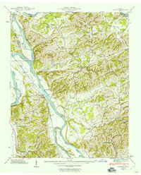
Other maps of this area

1883 · Morristown
USGS Topo · 1:125,000

1893 · Mt Guyot
USGS Topo · 1:125,000

1893 · Morristown
USGS Topo · 1:125,000

1895 · Morristown
USGS Topo · 1:125,000

1912 · Mt Guyot
USGS Topo · 1:125,000

1935 · Newport
USGS Topo · 1:48,000

1935 · White Pine
USGS Topo · 1:24,000

1935 · English Mountain
USGS Topo · 1:48,000

1935 · Parrottsville
USGS Topo · 1:24,000

1935 · Neddy Mountain
USGS Topo · 1:24,000