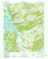
1961 Map of Rankin
USGS Topo · Published 1980About this map
French Broad Lake and its intricate shoreline dominate this area of East Tennessee, marking the geography where the Douglas River, Pigeon River, and French Broad River converge. This 1961 survey illustrates the rural landscape before major modernization, showing the intersection of Hamblen, Cocke, Jefferson, and Greene counties. Local life is anchored by small communities such as Rankin and Point Pleasant, with numerous family-named sites like Calfee Cem, Rogers Cem, and the Holitown McGowan Creek Ch providing vital clues for genealogists.
Find a feature on this map
88 named features on this map. Tap any name to fly to it.
Don’t see what you’re looking for? This feature index may not catch every label — zoom into the map to look around manually.
Map Details
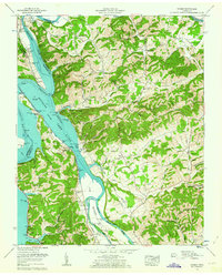
Editions of this 1961 Rankin Map
2 editions found
Other maps of this area

1883 · Morristown
USGS Topo · 1:125,000

1893 · Mt Guyot
USGS Topo · 1:125,000

1893 · Morristown
USGS Topo · 1:125,000

1895 · Morristown
USGS Topo · 1:125,000

1912 · Mt Guyot
USGS Topo · 1:125,000

1935 · Newport
USGS Topo · 1:48,000

1935 · White Pine
USGS Topo · 1:24,000

1935 · English Mountain
USGS Topo · 1:48,000

1935 · Parrottsville
USGS Topo · 1:24,000

1935 · Neddy Mountain
USGS Topo · 1:24,000