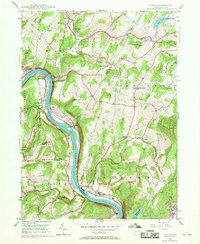
1946 Map of Ransom
USGS Topo · Published 1969About this map
The Susquehanna River carves a dramatic path through this region, flanked by the steep embankments of Wyoming, Luzerne, and Lackawanna counties. In the mid-20th century, this area supported a mix of institutional facilities and small riverside communities. The Ransom-Newton State Hospital occupies a prominent site near the riverbank, while the Lehigh Valley railroad tracks follow the water's edge, serving as a vital industrial artery.
Find a feature on this map
55 named features on this map. Tap any name to fly to it.
Don’t see what you’re looking for? This feature index may not catch every label — zoom into the map to look around manually.
Map Details
Editions of this 1946 Ransom Map
4 editions found

Other maps of this area

1889 · Scranton
USGS Topo · 1:62,500

1891 · Scranton
USGS Topo · 1:62,500

1892 · Dundaff
USGS Topo · 1:62,500

1893 · Pittston
USGS Topo · 1:62,500

1893 · Scranton
USGS Topo · 1:62,500

1943 · Scranton
USGS Topo · 1:125,000

1946 · Tunkhannock
USGS Topo · 1:62,500

1946 · Dalton
USGS Topo · 1:24,000

1946 · Kingston
USGS Topo · 1:24,000
1946 · Avoca
USGS Topo · 1:24,000
Featured Places
- Falls Township, PA
- Glenburn Township, PA
- Ransom Township, PA
- Upper Exeter, Exeter Township
- Mill City, Falls Township