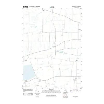
2010 Map of Ransomville
USGS Topo · Published 2010About this map
Model City and Ransomville anchor this area of Niagara County, where the landscape transitions from the agricultural flats near the northern lake plain toward the rising escarpment near Pekin. The settlement pattern reflects a deeply rooted network of hamlets and rural crossroads connected by historic routes like Balmer Rd and Upper Mountain Rd. A distinctive concentration of community institutions is evident, from Camp Stonehaven near Bond Lake to several significant burial grounds including Mount Hope Cemetery and Mount View Cemetery.
Find a feature on this map
56 named features on this map. Tap any name to fly to it.
Don’t see what you’re looking for? This feature index may not catch every label — zoom into the map to look around manually.
Map Details
Editions of this 2010 Ransomville Map
This is the sole edition of this map. No revisions or reprints were ever made.
Other maps of this area

1894 · Niagara Falls
USGS Topo · 1:62,500

1894 · Wilson
USGS Topo · 1:62,500

1896 · Niagara Falls
USGS Topo · 1:62,500

1897 · Tonawanda
USGS Topo · 1:62,500

1899 · Niagara
USGS Topo · 1:125,000

1900 · Wilson
USGS Topo · 1:62,500

1900 · Tonawanda
USGS Topo · 1:62,500

1900 · Niagara Falls
USGS Topo · 1:62,500

1901 · Niagara Falls
USGS Topo · 1:62,500

1901 · Tonawanda
USGS Topo · 1:62,500