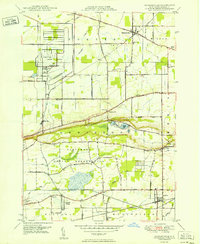
1950 Map of Ransomville
USGS Topo · Published 1950About this map
The Tuscarora Indian Reservation dominates the southern landscape of this Niagara County region, bounded by the prominent Mountain Ridge. This mid-century survey illustrates a transition between the industrial footprints of the United States Reservation and the planned residential layout of Model City. The rural character of the area is defined by a dense network of numbered schools, such as School No 7 and School No 10, serving agricultural settlements like Porter Center and Dickersonville.
Find a feature on this map
63 named features on this map. Tap any name to fly to it.
Don’t see what you’re looking for? This feature index may not catch every label — zoom into the map to look around manually.
Map Details
Editions of this 1950 Ransomville Map
This is the sole edition of this map. No revisions or reprints were ever made.
Other maps of this area

1894 · Niagara Falls
USGS Topo · 1:62,500

1894 · Wilson
USGS Topo · 1:62,500

1896 · Niagara Falls
USGS Topo · 1:62,500

1897 · Tonawanda
USGS Topo · 1:62,500

1899 · Niagara
USGS Topo · 1:125,000

1900 · Wilson
USGS Topo · 1:62,500

1900 · Tonawanda
USGS Topo · 1:62,500

1900 · Niagara Falls
USGS Topo · 1:62,500

1901 · Niagara Falls
USGS Topo · 1:62,500

1901 · Tonawanda
USGS Topo · 1:62,500