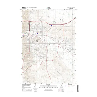
2015 Map of Rapid City East
USGS Topo · Published 2015About this map
Rapid City spreads across the western edge of this 2015 study, revealing a landscape where urban expansion meets complex irrigation history. The eastern suburbs of Rapid Valley and the smaller settlement of Murphy are clearly defined, surrounded by a network of historic waterways including the Iowa Ditch, Hawthorne Ditch, Murphy Ditch, and Cyclone Ditch. These man-made channels reflect the long-standing agricultural and water management traditions along the banks of Rapid Creek.
Find a feature on this map
120 named features on this map. Tap any name to fly to it.
Don’t see what you’re looking for? This feature index may not catch every label — zoom into the map to look around manually.
Map Details
Editions of this 2015 Rapid City East Map
This is the sole edition of this map. No revisions or reprints were ever made.
Other maps of this area

1893 · Rapid
USGS Topo · 1:125,000

1894 · Hermosa
USGS Topo · 1:125,000

1898 · Rapid
USGS Topo · 1:125,000

1901 · Hermosa
USGS Topo · 1:125,000

1903 · Rapid
USGS Topo · 1:125,000

1953 · Bend
USGS Topo · 1:24,000

1953 · Boxelder
USGS Topo · 1:24,000

1953 · Hermosa NW
USGS Topo · 1:24,000

1953 · Blackhawk
USGS Topo · 1:24,000

1953 · Rapid City East
USGS Topo · 1:24,000
Featured Places
- Rapid City, SD
- Box Elder, SD
- Twilight Hills Addition, Rapid City
- Rapid Valley, SD
- Sioux Village, Rapid City