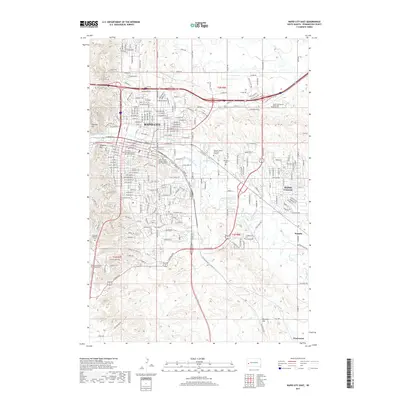
2017 Map of Rapid City East
USGS Topo · Published 2017About this map
Rapid City serves as the focal point of this 2017 survey, revealing the urban expansion and intricate water management systems required in this high plains environment. The landscape is defined by the winding course of Rapid Creek and a network of irrigation and drainage infrastructure including Iowa Ditch, Hawthorne Ditch, and Murphy Ditch. These waterways historically sustained the agricultural peripheries like Rapid Valley and the small settlement of Murphy. Educational and cultural landmarks are prominently featured, such as the South Dakota School of Mines and Technology and the Western Dakota Technical Institute, alongside memorial sites like Pine Lawn Memorial Park. Distinctive topographic rises, including Cowboy Hill and Hangman Hill, overlook the city's grid, while the southern reaches of the map transition into the more open terrain toward Warbonnet and the lower basin of Dry Cr.
Find a feature on this map
68 named features on this map. Tap any name to fly to it.
Don’t see what you’re looking for? This feature index may not catch every label — zoom into the map to look around manually.
Map Details
Editions of this 2017 Rapid City East Map
This is the sole edition of this map. No revisions or reprints were ever made.
Other maps of this area

1893 · Rapid
USGS Topo · 1:125,000

1894 · Hermosa
USGS Topo · 1:125,000

1898 · Rapid
USGS Topo · 1:125,000

1901 · Hermosa
USGS Topo · 1:125,000

1903 · Rapid
USGS Topo · 1:125,000

1953 · Bend
USGS Topo · 1:24,000

1953 · Boxelder
USGS Topo · 1:24,000

1953 · Hermosa NW
USGS Topo · 1:24,000

1953 · Blackhawk
USGS Topo · 1:24,000

1953 · Rapid City East
USGS Topo · 1:24,000
Featured Places
- Rapid City, SD
- Box Elder, SD
- Twilight Hills Addition, Rapid City
- Rapid Valley, SD
- Sioux Village, Rapid City