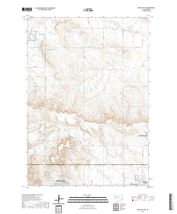
2021 Map of Rapid City NW
USGS Topo · Published 2021About this map
Rapid City and Box Elder define the southern edge of this landscape, where the northern suburbs and industrial fringes of Pennington County meet the rural reaches of Meade County. The terrain transitions from the developed streets of Ashland Heights to the open drainages of Boxelder Cr and Elk Creek. A sprawling network of county roads and section lines, such as Co Hwy Mc-4 and 143rd Ave, provides structure to the undulating hills north of the primary settlements. This area reflects the modern expansion of the Black Hills region's urban centers into the surrounding high plains. Evidence of earlier rural life remains visible at the Elk Vale Cem, while newer developments are traced along named routes like Coal Bank Dr and Creekside View Ln. Minor waterways including Morris Cr and Dry Cr carve through the northern townships, shaping the local topography.
Find a feature on this map
72 named features on this map. Tap any name to fly to it.
Don’t see what you’re looking for? This feature index may not catch every label — zoom into the map to look around manually.
Map Details
Editions of this 2021 Rapid City NW Map
This is the sole edition of this map. No revisions or reprints were ever made.
Other maps of this area

1893 · Rapid
USGS Topo · 1:125,000

1898 · Rapid
USGS Topo · 1:125,000

1903 · Rapid
USGS Topo · 1:125,000

1953 · Bend
USGS Topo · 1:24,000

1953 · Rapid City 1 SW
USGS Topo · 1:24,000

1953 · Boxelder
USGS Topo · 1:24,000

1953 · Blackhawk
USGS Topo · 1:24,000

1953 · Rapid City East
USGS Topo · 1:24,000

1953 · Rapid City NW
USGS Topo · 1:24,000

1953 · Rapid City West
USGS Topo · 1:24,000