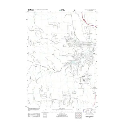
2012 Map of Rapid City West
USGS Topo · Published 2012About this map
Rapid Cr flows through a landscape defined by deep gulches and canyons in this 2012 survey of western South Dakota. The topography is marked by significant landmarks like Turkey Hill and Cowboy Hill, while the suburban expansion of the region is evident in named developments such as Ridgeland Heights, Broadmoor Subdivision, and the Wildwood Addition. This era of the city's growth shows a mix of recreation and specialized land use, ranging from the Meadowbrook Golf Course and Storybook Island to the Cleghorn Springs Fish Hatchery. Local history is anchored by the Gossage Memorial and the military presence at Camp Rapid. The map also captures several smaller outlying settlements like Schaeferville and the Clarkson Addition, providing a detailed view of the transition between the urban center and the surrounding rugged terrain of Cleghorn Canyon and Dark Canyon.
Find a feature on this map
193 named features on this map. Tap any name to fly to it.
Don’t see what you’re looking for? This feature index may not catch every label — zoom into the map to look around manually.
Map Details
Editions of this 2012 Rapid City West Map
This is the sole edition of this map. No revisions or reprints were ever made.
Other maps of this area

1893 · Rapid
USGS Topo · 1:125,000

1894 · Hermosa
USGS Topo · 1:125,000

1898 · Rapid
USGS Topo · 1:125,000

1901 · Hermosa
USGS Topo · 1:125,000

1903 · Rapid
USGS Topo · 1:125,000

1953 · Hermosa NW
USGS Topo · 1:24,000

1953 · Blackhawk
USGS Topo · 1:24,000

1953 · Rapid City East
USGS Topo · 1:24,000

1953 · Piedmont
USGS Topo · 1:24,000

1953 · Rapid City NW
USGS Topo · 1:24,000
Featured Places
- Rapid City, SD
- Clarkson Addition, SD
- Schaeferville, SD
- Broadmoor Subdivision, Rapid City
- Wildwood Addition, Rapid City