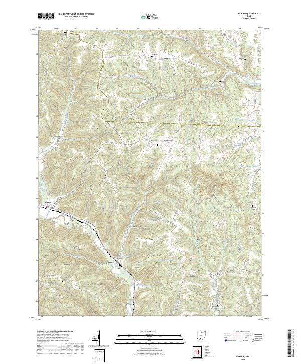
2023 Map of Rarden
USGS Topo · Published 2023About this map
Rarden sits at the western edge of this landscape, where Scioto Brush Creek and Rarden Creek meet among the steep ridges of the Scioto and Pike County border. The map documents a deeply dissected terrain characterized by high ridges like Thatcher Ridge and Powell Ridge separated by narrow hollows and runs. Small settlements such as Mount Joy and Ladd are connected by a network of winding township roads, reflecting the traditional rural settlement patterns of this part of southern Ohio. For genealogists and local historians, the sheet is particularly valuable for its documentation of numerous family and church burial grounds. Notable sites include Saint Patricks Cem in the south, Old Hackworth Cem near the center, and the remote Mount Olive Cem along Ladd Ridge. The inclusion of the Crabtree Cemetery Trl indicates the preservation of access to these ancestral sites within the modern landscape.
Find a feature on this map
100 named features on this map. Tap any name to fly to it.
Don’t see what you’re looking for? This feature index may not catch every label — zoom into the map to look around manually.
Map Details
Editions of this 2023 Rarden Map
This is the sole edition of this map. No revisions or reprints were ever made.
Other maps of this area

1915 · Bainbridge
USGS Topo · 1:48,000

1915 · Otway
USGS Topo · 1:62,500

1915 · Piketon
USGS Topo · 1:62,500

1916 · Peebles
USGS Topo · 1:62,500

1917 · Bainbridge
USGS Topo · 1:62,500

1917 · Piketon
USGS Topo · 1:62,500

1917 · Otway
USGS Topo · 1:62,500

1918 · Peebles
USGS Topo · 1:62,500

1944 · Piketon
USGS Topo · 1:62,500

1947 · Columbus
USGS Topo · 1:250,000