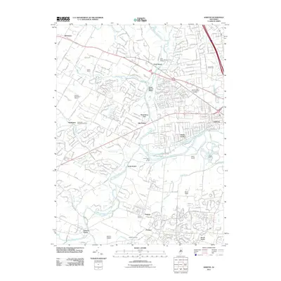
2011 Map of Raritan
USGS Topo · Published 2011About this map
The North Branch-Raritan River and South Branch Raritan River converge in this Somerset County landscape, framing a series of historical hamlets and industrial remnants. At the turn of the 21st century, the area maintains a balance between suburban expansion and deep-rooted ancestral sites, evidenced by the numerous small graveyards such as the Vroom Family Burial Ground and Veghte Burying Ground near the riverbanks. The transportation corridor is anchored by North Branch Depot and Neshanic Station, while the Raritan Water Power Canal reflects the region's historical reliance on water for industry. To the southeast, the expansive Duke Estate occupies a significant portion of the riverfront, contrasting with the concentrated residential developments of Bradley Gardens and the borough of Raritan. Aviation history is also represented by the presence of Peters Airport and Solberg-Hunterdon Airport in the western reaches.
Find a feature on this map
53 named features on this map. Tap any name to fly to it.
Don’t see what you’re looking for? This feature index may not catch every label — zoom into the map to look around manually.
Map Details
Editions of this 2011 Raritan Map
This is the sole edition of this map. No revisions or reprints were ever made.
Other maps of this area

1888 · Princeton
USGS Topo · 1:62,500

1890 · High Bridge
USGS Topo · 1:62,500

1890 · Lambertville
USGS Topo · 1:62,500

1891 · Somerville
USGS Topo · 1:62,500

1891 · Lambertville
USGS Topo · 1:62,500

1893 · Somerville
USGS Topo · 1:62,500

1894 · Princeton
USGS Topo · 1:62,500

1894 · Lambertville
USGS Topo · 1:62,500

1898 · High Bridge
USGS Topo · 1:62,500

1898 · Somerville
USGS Topo · 1:62,500
Featured Places
- Bridgewater Township, NJ
- Hillsborough Township, NJ
- Readington Township, NJ
- Somerville, NJ
- Bedminster Township, NJ