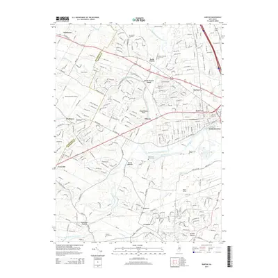
2014 Map of Raritan
USGS Topo · Published 2014About this map
Raritan and Somerville anchor the eastern edge of this landscape where the North Branch Raritan River and South Branch Raritan River converge. The area is defined by a dense network of water systems, including the historic Raritan Water Power Canal and numerous family landmarks like the Vroom Family Burial Ground and Veghte Burying Ground. Smaller communities such as North Branch Depot, Flagtown, and Neshanic Station dot the countryside, connected by major transit corridors like Us-22 and Us-202. Higher education and aviation are represented by the Raritan Valley Community College campus and Somerset Airport, reflecting the region's modern suburban development while preserved cemeteries and church yards at Readington and North Branch maintain a tangible link to local family lineages.
Find a feature on this map
50 named features on this map. Tap any name to fly to it.
Don’t see what you’re looking for? This feature index may not catch every label — zoom into the map to look around manually.
Map Details
Editions of this 2014 Raritan Map
This is the sole edition of this map. No revisions or reprints were ever made.
Other maps of this area

1888 · Princeton
USGS Topo · 1:62,500

1890 · High Bridge
USGS Topo · 1:62,500

1890 · Lambertville
USGS Topo · 1:62,500

1891 · Somerville
USGS Topo · 1:62,500

1891 · Lambertville
USGS Topo · 1:62,500

1893 · Somerville
USGS Topo · 1:62,500

1894 · Princeton
USGS Topo · 1:62,500

1894 · Lambertville
USGS Topo · 1:62,500

1898 · High Bridge
USGS Topo · 1:62,500

1898 · Somerville
USGS Topo · 1:62,500
Featured Places
- Bridgewater Township, NJ
- Hillsborough Township, NJ
- Readington Township, NJ
- Somerville, NJ
- Bedminster Township, NJ