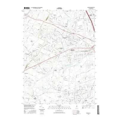
2016 Map of Raritan
USGS Topo · Published 2016About this map
The North Branch Raritan River and South Branch Raritan River converge here, framing a landscape defined by its historic watercourses and colonial-era settlement patterns. The confluence is marked by the Raritan Water Power Canal and the primary town center of Raritan. Small hamlets and crossroads like Neshanic Station, Flagtown, and Readington are documented with their respective local landmarks, including the Readington Reformed Church Yard and the Hoagland Cem.
Find a feature on this map
50 named features on this map. Tap any name to fly to it.
Don’t see what you’re looking for? This feature index may not catch every label — zoom into the map to look around manually.
Map Details
Editions of this 2016 Raritan Map
This is the sole edition of this map. No revisions or reprints were ever made.
Other maps of this area

1888 · Princeton
USGS Topo · 1:62,500

1890 · High Bridge
USGS Topo · 1:62,500

1890 · Lambertville
USGS Topo · 1:62,500

1891 · Somerville
USGS Topo · 1:62,500

1891 · Lambertville
USGS Topo · 1:62,500

1893 · Somerville
USGS Topo · 1:62,500

1894 · Princeton
USGS Topo · 1:62,500

1894 · Lambertville
USGS Topo · 1:62,500

1898 · High Bridge
USGS Topo · 1:62,500

1898 · Somerville
USGS Topo · 1:62,500
Featured Places
- Bridgewater Township, NJ
- Hillsborough Township, NJ
- Readington Township, NJ
- Somerville, NJ
- Bedminster Township, NJ