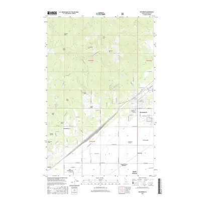
2017 Map of Rathdrum
USGS Topo · Published 2017About this map
Rathdrum and the northern reaches of Post Falls define this Kootenai County landscape, where the flat expanse of the Rathdrum Prairie meets the dramatic rise of Rathdrum Mtn. The transition from suburban development to the timbered slopes of the Bitterroot foothills is marked by named geographical features such as Huckleberry Hill, Nelson Canyon, and Swansons Chute. Agriculture and irrigation history are visible in the layout of the E Greenacres Main Ditch and the E Greenacres N Ditch serving the East Greenacres area.
Find a feature on this map
93 named features on this map. Tap any name to fly to it.
Don’t see what you’re looking for? This feature index may not catch every label — zoom into the map to look around manually.
Map Details
Editions of this 2017 Rathdrum Map
This is the sole edition of this map. No revisions or reprints were ever made.
Other maps of this area

1901 · Spokane
USGS Topo · 1:125,000

1903 · Rathdrum
USGS Topo · 1:125,000

1943 · Mt Spokane
USGS Topo · 1:62,500

1949 · Greenacres
USGS Topo · 1:62,500

1950 · Mt Spokane
USGS Topo · 1:62,500

1951 · Greenacres
USGS Topo · 1:62,500

1955 · Spokane
USGS Topo · 1:250,000

1957 · Coeur D'Alene
USGS Topo · 1:62,500

1958 · Spokane
USGS Topo · 1:250,000

1961 · Hayden
USGS Topo · 1:24,000