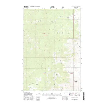
2017 Map of Ratio Mountain
USGS Topo · Published 2017About this map
Deerlodge National Forest dominates this section of Jefferson County, where the high mountain terrain of the Boulder Batholith landscape is deeply incised by drainages like State Cr and Little Whitetail Cr. The map highlights a remote wilderness defined by prominent peaks including Ratio Mtn and Goodwin Mtn, which overlook high-elevation open spaces such as Lower Whitetail Park and the ominous Poison Flats. The influence of early 20th-century resource extraction and backcountry access is evident through the inclusion of State Mine Rd and the network of forest routes that navigate through Whitetail Valley. Critical water sources for both wildlife and travelers in this arid mountain environment are meticulously marked, ranging from the man-made Keogh Reservoir to natural seeps like Wildhorse Spring and Roadside Spring, providing essential waypoints for anyone navigating the deep canyons and timbered slopes of the Elkhorn Mountains.
Find a feature on this map
26 named features on this map. Tap any name to fly to it.
Don’t see what you’re looking for? This feature index may not catch every label — zoom into the map to look around manually.
Map Details
Editions of this 2017 Ratio Mountain Map
This is the sole edition of this map. No revisions or reprints were ever made.
Other maps of this area

1889 · Helena
USGS Topo · 1:250,000

1893 · Helena
USGS Topo · 1:250,000

1893 · Dillon
USGS Topo · 1:250,000

1899 · Boulder
USGS Topo · 1:125,000

1899 · Helena
USGS Topo · 1:250,000

1903 · Helena
USGS Topo · 1:250,000

1947 · Butte
USGS Topo · 1:250,000

1954 · Elk Park
USGS Topo · 1:62,500

1954 · Boulder
USGS Topo · 1:62,500

1955 · Dillon
USGS Topo · 1:250,000