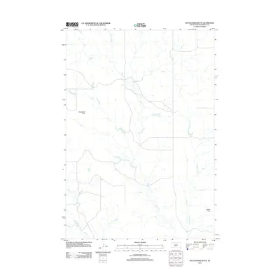
2012 Map of Rattlesnake Butte
USGS Topo · Published 2012About this map
Rattlesnake Butte rises above the plains of Ziebach County, anchoring a landscape defined by the branching drainage systems of the Cheyenne River watershed. This early 21st-century survey documents a sparse, high-plains environment where water dictates the geography. The primary artery of Rattlesnake Cr is joined by its eastern tributaries, E Rattlesnake Cr and E E Rattlesnake Cr, creating a complex network of draws and intermittent streams. Evidence of human settlement in this cattle-country terrain is localized at the Diermier Ranch, while the isolated landform of Peaked Butte serves as a distinct navigational landmark in the southeast. In the southwestern corner, the headwaters of Red Coat Cr provide a glimpse into the localized hydrology of the Great Plains before they flow toward more distant confluences.
Find a feature on this map
7 named features on this map. Tap any name to fly to it.
Don’t see what you’re looking for? This feature index may not catch every label — zoom into the map to look around manually.
Map Details
Editions of this 2012 Rattlesnake Butte Map
This is the sole edition of this map. No revisions or reprints were ever made.
Other maps of this area

1953 · McIntosh
USGS Topo · 1:250,000

1954 · Pierre
USGS Topo · 1:250,000

1958 · Pierre
USGS Topo · 1:250,000

1958 · McIntosh
USGS Topo · 1:250,000

1979 · Dupree
USGS Topo · 1:25,000

1982 · Chasing Hawk Draw
USGS Topo · 1:24,000

1982 · Bull Creek 2 NE
USGS Topo · 1:24,000

1982 · Bessie Butte
USGS Topo · 1:24,000

1982 · Red Scaffold
USGS Topo · 1:24,000

1982 · Longbrake Ranch
USGS Topo · 1:24,000