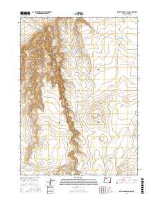
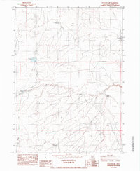
2017 Map of Rattlesnake Canyon
USGS Topo · Published 2017About this map
Rattlesnake Canyon and its adjacent drainages dominate this high-desert landscape in southeastern Oregon, where water management is central to the local geography. A series of catchment features, including Lower Chimney Creek Reservoir, Upper Chimney Creek Reservoir, and the Holding Corral Reservoir, illustrate the historical and ongoing importance of livestock grazing in this arid region. These man-made improvements sit alongside natural landmarks such as Little Grassy Mtn and Coyote Spring.
Find a feature on this map
22 named features on this map. Tap any name to fly to it.
Don’t see what you’re looking for? This feature index may not catch every label — zoom into the map to look around manually.
Map Details
Editions of this 2017 Rattlesnake Canyon Map
This is the sole edition of this map. No revisions or reprints were ever made.
Other maps of this area

1955 · Jordan Valley
USGS Topo · 1:250,000

1957 · Jordan Valley
USGS Topo · 1:250,000

1958 · Jordan Valley
USGS Topo · 1:250,000

1979 · Bowden Ranch
USGS Topo · 1:24,000
1980 · Caviatta Ridge
USGS Topo · 1:24,000
1980 · Jackies Butte
USGS Topo · 1:24,000

1982 · Battle Mtn
USGS Topo · 1:24,000

1982 · Rattlesnake Canyon
USGS Topo · 1:24,000
1982 · Starvation Spring
USGS Topo · 1:24,000
1982 · Peacock Lake
USGS Topo · 1:24,000