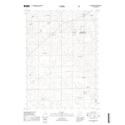
2018 Map of Rattlesnake Draw
USGS Topo · Published 2018About this map
Thunder Basin National Grassland dominates this high plains landscape of Campbell County, where public lands and ranching history converge. The settlement of Wright sits at the northeastern edge, serving as a gateway to the vast drainage networks of Porcupine Cr and Hay Cr. The terrain is defined by prominent landmarks like Rattlesnake Butte and Rocky Butte, alongside deep erosional features such as Rattlesnake Draw and Rocky Butte Gulch. This 2018 survey illustrates the modern road network, including Gunner Rd and Cosner Rd, which navigate the township and range divisions of the Tbng. The intricate web of intermittent streams, from Billie Cr to Spring Cr, highlights the importance of water management in this arid cattle-country environment.
Find a feature on this map
24 named features on this map. Tap any name to fly to it.
Don’t see what you’re looking for? This feature index may not catch every label — zoom into the map to look around manually.
Map Details
Editions of this 2018 Rattlesnake Draw Map
This is the sole edition of this map. No revisions or reprints were ever made.
Other maps of this area

1955 · Newcastle
USGS Topo · 1:250,000

1958 · Newcastle
USGS Topo · 1:250,000

1959 · North Star School
USGS Topo · 1:62,500

1960 · Turnercrest
USGS Topo · 1:62,500

1971 · Reno Junction
USGS Topo · 1:24,000

1971 · Little Thunder Reservoir
USGS Topo · 1:24,000

1971 · Teckla SW
USGS Topo · 1:24,000

1974 · Reno Junction
USGS Topo · 1:100,000

1984 · Turnercrest
USGS Topo · 1:24,000
1984 · Reno Flats
USGS Topo · 1:24,000