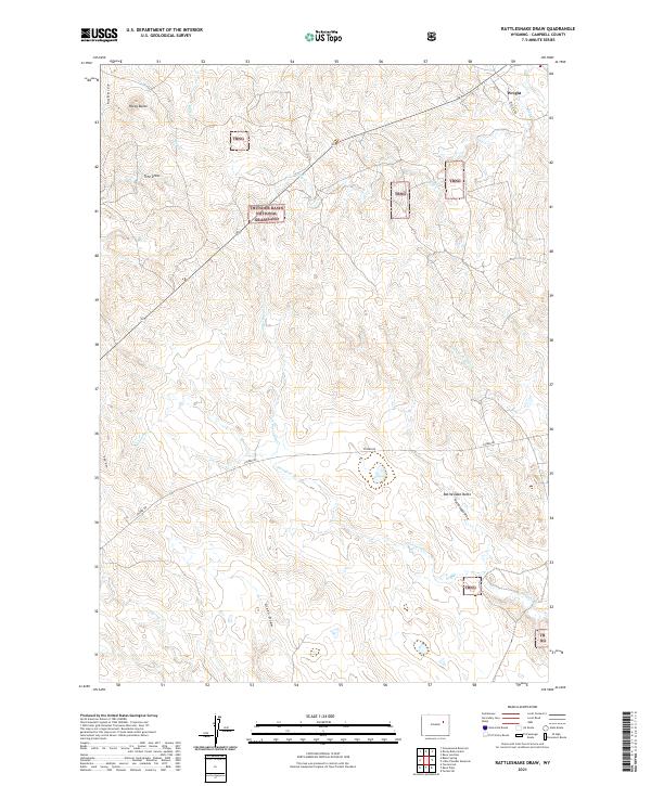
2021 Map of Rattlesnake Draw
USGS Topo · Published 2021About this map
Thunder Basin National Grassland dominates this high plains landscape, characterized by an intricate drainage system of seasonal creeks and draws. In the northeast corner, the settlement of Wright stands near the intersection of several local routes, including Melicia Dr. The topography is defined by distinct landmarks such as Rattlesnake Butte and Rocky Butte, which provide vertical relief above the surrounding rangeland.
Find a feature on this map
24 named features on this map. Tap any name to fly to it.
Don’t see what you’re looking for? This feature index may not catch every label — zoom into the map to look around manually.
Map Details
Editions of this 2021 Rattlesnake Draw Map
This is the sole edition of this map. No revisions or reprints were ever made.
Other maps of this area

1955 · Newcastle
USGS Topo · 1:250,000

1958 · Newcastle
USGS Topo · 1:250,000

1959 · North Star School
USGS Topo · 1:62,500

1960 · Turnercrest
USGS Topo · 1:62,500

1971 · Reno Junction
USGS Topo · 1:24,000

1971 · Little Thunder Reservoir
USGS Topo · 1:24,000

1971 · Teckla SW
USGS Topo · 1:24,000

1974 · Reno Junction
USGS Topo · 1:100,000

1984 · Turnercrest
USGS Topo · 1:24,000
1984 · Reno Flats
USGS Topo · 1:24,000