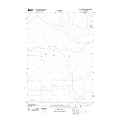
2012 Map of Rattlesnake Lake SE
USGS Topo · Published 2012About this map
The Cheyenne River winds through this expansive landscape of the Cheyenne River Indian Reservation, carving a wide valley that includes White Thunder Bottom and the White Thunder Ranch. The terrain is defined by a series of significant drainage systems, including Swan Draw, Eagle Chasing Draw, and Curtis Draw, which reveal the complex hydrology of the western South Dakota plains. To the north, the settlement of Cherry Creek sits near the confluence of Cherry Cr and the main river, serving as a focal point for the region's limited road network, which includes Bia HWY 8 and Bia HWY 6. Further south, the landscape is marked by the unique Staben Strip and named water sources like Beerwagon Spring, illustrating the importance of specific landmarks and water access in this sparsely populated prairie environment.
Find a feature on this map
19 named features on this map. Tap any name to fly to it.
Don’t see what you’re looking for? This feature index may not catch every label — zoom into the map to look around manually.
Map Details
Editions of this 2012 Rattlesnake Lake SE Map
This is the sole edition of this map. No revisions or reprints were ever made.
Other maps of this area

1954 · Pierre
USGS Topo · 1:250,000

1955 · Rattlesnake Lake SE
USGS Topo · 1:24,000

1955 · Rattlesnake Lake SW
USGS Topo · 1:24,000

1955 · Rattlesnake Lake
USGS Topo · 1:24,000

1955 · Rattlesnake Lake NE
USGS Topo · 1:24,000

1956 · Cherry Creek NW
USGS Topo · 1:24,000

1956 · Cherry Creek
USGS Topo · 1:24,000

1958 · Pierre
USGS Topo · 1:250,000

1983 · Philip
USGS Topo · 1:100,000

1983 · Milesville
USGS Topo · 1:24,000