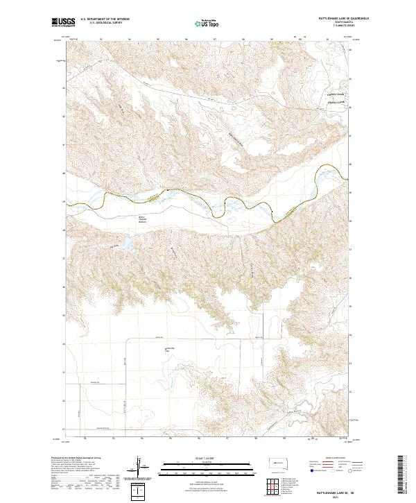
2021 Map of Rattlesnake Lake SE
USGS Topo · Published 2021About this map
The Cheyenne River snakes through this 2021 landscape, defining the border between Ziebach County and Haakon County. The river valley features distinctive bottomlands like White Thunder Bottom and is fed by various seasonal drainages, including Swan Draw and Eagle Chasing Draw. To the north, the settlement of Cherry Creek sits near the confluence of the river and Cherry Cr, serving as a focal point for the region's scattered road network.
Find a feature on this map
32 named features on this map. Tap any name to fly to it.
Don’t see what you’re looking for? This feature index may not catch every label — zoom into the map to look around manually.
Map Details
Editions of this 2021 Rattlesnake Lake SE Map
This is the sole edition of this map. No revisions or reprints were ever made.
Other maps of this area

1954 · Pierre
USGS Topo · 1:250,000

1955 · Rattlesnake Lake SE
USGS Topo · 1:24,000

1955 · Rattlesnake Lake SW
USGS Topo · 1:24,000

1955 · Rattlesnake Lake
USGS Topo · 1:24,000

1955 · Rattlesnake Lake NE
USGS Topo · 1:24,000

1956 · Cherry Creek NW
USGS Topo · 1:24,000

1956 · Cherry Creek
USGS Topo · 1:24,000

1958 · Pierre
USGS Topo · 1:250,000

1983 · Philip
USGS Topo · 1:100,000

1983 · Milesville
USGS Topo · 1:24,000