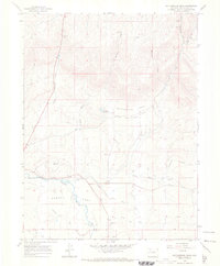
1966 Map of Rattlesnake Mesa
USGS Topo · Published 1970About this map
Agency Park dominates the southern landscape of this Rio Blanco County region, where the White River flows through a broad valley defined by an intricate network of irrigation systems. The reliance on water management for agriculture is evident through features like the Coal Creek Mesa Ditch, Highland Ditch, and Oak Ridge Park Ditch, which redirect flow from tributaries to the higher benches. North of the river, the terrain rises sharply toward the namesake Rattlesnake Mesa and the geological prominent of Meeker Dome. This 1966 survey documents the industrial footprint of the era, including the Rienau Mine and multiple Gravel Pits, alongside water infrastructure such as the Mc Hatton Reservoir and various gaging stations. The map reflects a landscape of rugged canyons and draws, including Dickersville Creek and Aichers Draw, shaped by both natural drainage and human engineering.
Find a feature on this map
25 named features on this map. Tap any name to fly to it.
Don’t see what you’re looking for? This feature index may not catch every label — zoom into the map to look around manually.
Map Details
Editions of this 1966 Rattlesnake Mesa Map
This is the sole edition of this map. No revisions or reprints were ever made.
Other maps of this area

1906 · Grand Hogback
USGS Topo · 1:125,000

1910 · Danforth Hills
USGS Topo · 1:125,000

1910 · Grand Hogback
USGS Topo · 1:125,000

1912 · Meeker
USGS Topo · 1:62,500

1914 · Meeker
USGS Topo · 1:62,500

1954 · Craig
USGS Topo · 1:250,000

1957 · Craig
USGS Topo · 1:250,000

1957 · Leadville
USGS Topo · 1:250,000

1958 · Craig
USGS Topo · 1:250,000

1959 · Leadville
USGS Topo · 1:250,000