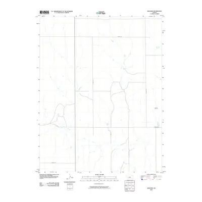
2009 Map of Ravanna
USGS Topo · Published 2009About this map
Ravanna and its surrounding plains are documented here in the early twenty-first century, showing a landscape defined by organized section-line roads and the meandering path of the Pawnee River. The settlement itself, once a bustling county seat contender in the late 19th century, appears here as a quiet locality situated at the intersection of N Ravana Rd and E Lake Rd. The presence of the Garfield Cemetery to the north serves as a tangible link to the area's early homesteading families. The map illustrates a highly structured agricultural environment where named routes like N Boone Rd, N Myers Rd, and E Potter Rd partition the terrain into precise grids, a hallmark of the Great Plains' settlement patterns. Small depressions and seasonal water features are scattered across the landscape, indicating the natural drainage system feeding into the river valley.
Find a feature on this map
10 named features on this map. Tap any name to fly to it.
Don’t see what you’re looking for? This feature index may not catch every label — zoom into the map to look around manually.
Map Details
Editions of this 2009 Ravanna Map
This is the sole edition of this map. No revisions or reprints were ever made.
Other maps of this area

1955 · Scott City
USGS Topo · 1:250,000

1958 · Scott City
USGS Topo · 1:250,000

1974 · Ravanna
USGS Topo · 1:24,000
1974 · Kalvesta
USGS Topo · 1:24,000
1974 · Scott City 4 SE
USGS Topo · 1:24,000

1974 · Dighton SW
USGS Topo · 1:24,000

1974 · Amy SE
USGS Topo · 1:24,000

1974 · Scott City 4 NE
USGS Topo · 1:24,000

1974 · Hay Canyon
USGS Topo · 1:24,000

1974 · Dighton SE
USGS Topo · 1:24,000