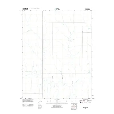
2012 Map of Ravanna
USGS Topo · Published 2012About this map
Ravanna sits in the high plains of western Kansas, serving as the focal point of this Finney County landscape. The area is defined by the winding course of the Pawnee River, which cuts through the terrain from the west toward the southeast. This 2012 survey shows the persistent grid of rural section roads, including N Ravana Rd and E Lake Rd, that define the region's agricultural boundaries. Local history researchers will find the Garfield Cem positioned north of the settlement, a significant landmark for tracing early families in this part of the state. The landscape is sparse, with small seasonal tributaries and drainages feeding into the river, illustrating the delicate water management required for farming in the plains. This topographic study documents the township structure and the enduring layout of the remote high plains before modern development significantly altered the rural character.
Find a feature on this map
12 named features on this map. Tap any name to fly to it.
Don’t see what you’re looking for? This feature index may not catch every label — zoom into the map to look around manually.
Map Details
Editions of this 2012 Ravanna Map
This is the sole edition of this map. No revisions or reprints were ever made.
Other maps of this area

1955 · Scott City
USGS Topo · 1:250,000

1958 · Scott City
USGS Topo · 1:250,000

1974 · Ravanna
USGS Topo · 1:24,000
1974 · Kalvesta
USGS Topo · 1:24,000
1974 · Scott City 4 SE
USGS Topo · 1:24,000

1974 · Dighton SW
USGS Topo · 1:24,000

1974 · Amy SE
USGS Topo · 1:24,000

1974 · Scott City 4 NE
USGS Topo · 1:24,000

1974 · Hay Canyon
USGS Topo · 1:24,000

1974 · Dighton SE
USGS Topo · 1:24,000