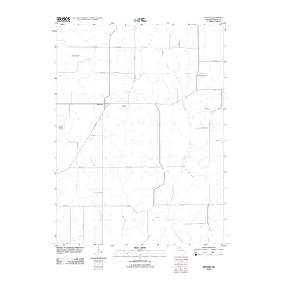
2012 Map of Ravanna
USGS Topo · Published 2012About this map
Ravanna serves as the central hub of this Mercer County landscape, where the rural road network converges near the Ravanna Cemetery. The terrain is defined by a series of north-south drainage systems, including the winding course of Little Medicine Creek in the east and West Honey Creek further west. This 2012 survey illustrates a classic Midwestern agricultural pattern of section-line roads and dispersed farmsteads, punctuated by small family and community burial grounds. Genealogists will find the locations of Duree Cemetery, Anderson Cemetery, and Weisner Cemetery particularly valuable for tracing local heritage. These sites are linked by a dense grid of county routes like Co HWY-94 and Co HWY-127, which reflect the long-standing land divisions of northern Missouri.
Find a feature on this map
46 named features on this map. Tap any name to fly to it.
Don’t see what you’re looking for? This feature index may not catch every label — zoom into the map to look around manually.
Map Details
Editions of this 2012 Ravanna Map
This is the sole edition of this map. No revisions or reprints were ever made.
Other maps of this area

1946 · Princeton
USGS Topo · 1:62,500

1948 · Princeton
USGS Topo · 1:62,500

1954 · Centerville
USGS Topo · 1:250,000

1957 · Centerville
USGS Topo · 1:250,000

1958 · Centerville
USGS Topo · 1:250,000

1964 · Ravanna
USGS Topo · 1:24,000

1964 · Harris
USGS Topo · 1:24,000

1964 · Half Rock
USGS Topo · 1:24,000

1964 · Lucerne
USGS Topo · 1:24,000

1964 · Cleopatra
USGS Topo · 1:24,000