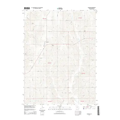
2014 Map of Ravanna
USGS Topo · Published 2014About this map
Ravanna sits at the center of this rural Mercer County landscape, where the local road network follows the rigorous grid of the Public Land Survey System. The terrain is defined by the drainage patterns of Little Medicine Cr and W Honey Cr, which cut through the undulating Missouri countryside. For genealogists and local historians, the map is a significant record of the community’s ancestors, precisely locating several burial grounds including Ravanna Cemetery, Duree Cemetery, Anderson Cemetery, and Weisner Cemetery. These cemeteries, often positioned on high ground or near creek bends, serve as the primary landmarks in an area dominated by agricultural sections. The modern transportation corridors, such as Mo-Aa, provide the primary east-west access through the township sections of T65N and T66N, connecting the isolated farmsteads and creek valleys.
Find a feature on this map
35 named features on this map. Tap any name to fly to it.
Don’t see what you’re looking for? This feature index may not catch every label — zoom into the map to look around manually.
Map Details
Editions of this 2014 Ravanna Map
This is the sole edition of this map. No revisions or reprints were ever made.
Other maps of this area

1946 · Princeton
USGS Topo · 1:62,500

1948 · Princeton
USGS Topo · 1:62,500

1954 · Centerville
USGS Topo · 1:250,000

1957 · Centerville
USGS Topo · 1:250,000

1958 · Centerville
USGS Topo · 1:250,000

1964 · Ravanna
USGS Topo · 1:24,000

1964 · Harris
USGS Topo · 1:24,000

1964 · Half Rock
USGS Topo · 1:24,000

1964 · Lucerne
USGS Topo · 1:24,000

1964 · Cleopatra
USGS Topo · 1:24,000