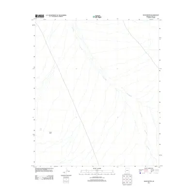
2011 Map of Raven Butte
USGS Topo · Published 2011About this map
Coyote Wash dominates this arid Yuma County landscape, winding northwest to southeast across a terrain defined by desert drainage patterns. In the southwestern portion of the quadrangle, the prominent elevation of Raven Butte rises above the surrounding flats, serving as a significant geographical anchor. Nearby, Raven Butte Tank suggests the critical importance of water management and catchment in this part of Arizona. The map illustrates a landscape largely shaped by natural features and ephemeral watercourses, with very little modern development or infrastructure recorded beyond the essential landmarks required for navigation and resource identification in a desert environment.
Find a feature on this map
3 named features on this map. Tap any name to fly to it.
Don’t see what you’re looking for? This feature index may not catch every label — zoom into the map to look around manually.
Map Details
Editions of this 2011 Raven Butte Map
This is the sole edition of this map. No revisions or reprints were ever made.
Other maps of this area

1926 · Wellton
USGS Topo · 1:62,500

1926 · Mohawk
USGS Topo · 1:62,500

1928 · Mohawk
USGS Topo · 1:62,500

1929 · Wellton
USGS Topo · 1:62,500

1942 · Yuma
USGS Topo · 1:250,000

1953 · Ajo
USGS Topo · 1:250,000

1954 · El Centro
USGS Topo · 1:250,000

1955 · El Centro
USGS Topo · 1:250,000

1957 · Ajo
USGS Topo · 1:250,000

1958 · Ajo
USGS Topo · 1:250,000