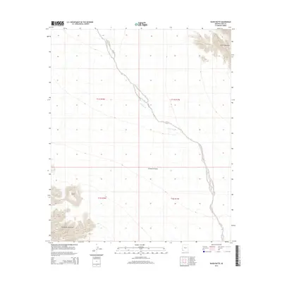
2014 Map of Raven Butte
USGS Topo · Published 2014About this map
Coyote Wash carves a winding path through the arid expanse of Yuma County, defining the drainage patterns of this southwestern desert landscape. The terrain is dominated by the stark elevations of the Tinajas Altas Mountains in the south and the Copper Mountains in the northeast, which border the open stretches of the Lechuguilla Desert. This 2014 survey documents a region defined by its topography rather than settlement, where water management is highlighted by the isolated Raven Butte Tank near the prominent Raven Butte. The map provides a clear record of the Township and Range boundaries, such as t11s r18w and t12s r17w, which organize this largely undeveloped public land. It serves as a vital reference for understanding the physical geography and hydrological markers of the Arizona borderlands.
Find a feature on this map
10 named features on this map. Tap any name to fly to it.
Don’t see what you’re looking for? This feature index may not catch every label — zoom into the map to look around manually.
Map Details
Editions of this 2014 Raven Butte Map
This is the sole edition of this map. No revisions or reprints were ever made.
Other maps of this area

1926 · Wellton
USGS Topo · 1:62,500

1926 · Mohawk
USGS Topo · 1:62,500

1928 · Mohawk
USGS Topo · 1:62,500

1929 · Wellton
USGS Topo · 1:62,500

1942 · Yuma
USGS Topo · 1:250,000

1953 · Ajo
USGS Topo · 1:250,000

1954 · El Centro
USGS Topo · 1:250,000

1955 · El Centro
USGS Topo · 1:250,000

1957 · Ajo
USGS Topo · 1:250,000

1958 · Ajo
USGS Topo · 1:250,000