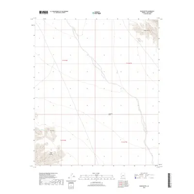
2018 Map of Raven Butte
USGS Topo · Published 2018About this map
Coyote Wash carves a winding path through the arid floor of the Lechuguilla Desert, serving as the primary drainage for this corner of the Sonoran landscape. The terrain is defined by dramatic geological formations, with the Tinajas Altas Mountains rising in the southwest and the Copper Mountains visible in the northeast. This 2018 survey captures the intricate topographical details of the basin, where the isolated peak of Raven Butte stands near the man-made Raven Butte Tank. The presence of this tank suggests a critical point of water management for local wildlife or historical grazing in an area otherwise dominated by expansive desert flats and steep mountain slopes.
Find a feature on this map
10 named features on this map. Tap any name to fly to it.
Don’t see what you’re looking for? This feature index may not catch every label — zoom into the map to look around manually.
Map Details
Editions of this 2018 Raven Butte Map
This is the sole edition of this map. No revisions or reprints were ever made.
Other maps of this area

1926 · Wellton
USGS Topo · 1:62,500

1926 · Mohawk
USGS Topo · 1:62,500

1928 · Mohawk
USGS Topo · 1:62,500

1929 · Wellton
USGS Topo · 1:62,500

1942 · Yuma
USGS Topo · 1:250,000

1953 · Ajo
USGS Topo · 1:250,000

1954 · El Centro
USGS Topo · 1:250,000

1955 · El Centro
USGS Topo · 1:250,000

1957 · Ajo
USGS Topo · 1:250,000

1958 · Ajo
USGS Topo · 1:250,000