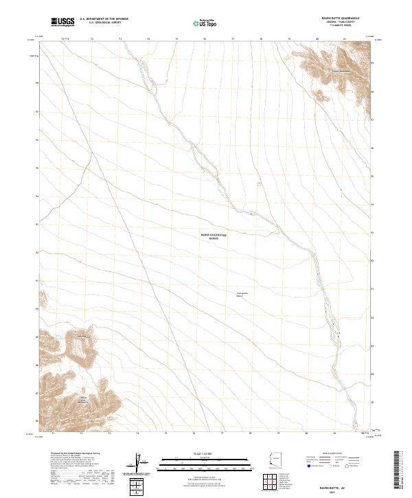
2021 Map of Raven Butte
USGS Topo · Published 2021About this map
The Lechuguilla Desert landscape is defined by its arid drainage systems and isolated peaks, centered on the prominent Raven Butte and the nearby Raven Butte Tank. This map shows the extreme southwestern Arizona terrain where the Copper Mountains rise in the northeast and the Tinajas Altas Mountains dominate the southwestern corner. The vast, braided corridor of Coyote Wash snakes diagonally across the sheet from the northwest to the southeast, illustrating the primary hydrologic path through this desert expanse. The grid of township and range lines, including t11s r18w and t12s r17w, provides the only human-imposed structure over a landscape otherwise shaped by natural landforms and seasonal watercourses.
Find a feature on this map
10 named features on this map. Tap any name to fly to it.
Don’t see what you’re looking for? This feature index may not catch every label — zoom into the map to look around manually.
Map Details
Editions of this 2021 Raven Butte Map
This is the sole edition of this map. No revisions or reprints were ever made.
Other maps of this area

1926 · Wellton
USGS Topo · 1:62,500

1926 · Mohawk
USGS Topo · 1:62,500

1928 · Mohawk
USGS Topo · 1:62,500

1929 · Wellton
USGS Topo · 1:62,500

1942 · Yuma
USGS Topo · 1:250,000

1953 · Ajo
USGS Topo · 1:250,000

1954 · El Centro
USGS Topo · 1:250,000

1955 · El Centro
USGS Topo · 1:250,000

1957 · Ajo
USGS Topo · 1:250,000

1958 · Ajo
USGS Topo · 1:250,000