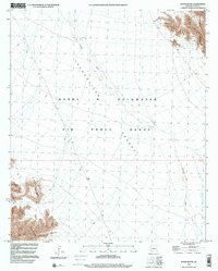
1997 Map of Raven Butte
USGS Topo · Published 2000About this map
The Lechuguilla Desert defines this stretch of the Sonoran landscape, dominated by the restricted expanse of the Barry M Goldwater Air Force Range. The map reveals a land shaped by both military use and early mining, with a network of 4wd tracks cutting across the arid flats toward the Copper Mountains in the northeast. This 1997 update of earlier 1962 topography shows the persistent isolation of the region, where water sources like Coyote Wash and the Raven Butte Tank are critical markers in an otherwise unforgiving environment.
Find a feature on this map
12 named features on this map. Tap any name to fly to it.
Don’t see what you’re looking for? This feature index may not catch every label — zoom into the map to look around manually.
Map Details
Editions of this 1997 Raven Butte Map
This is the sole edition of this map. No revisions or reprints were ever made.
Other maps of this area

1926 · Wellton
USGS Topo · 1:62,500

1926 · Mohawk
USGS Topo · 1:62,500

1928 · Mohawk
USGS Topo · 1:62,500

1929 · Wellton
USGS Topo · 1:62,500

1942 · Yuma
USGS Topo · 1:250,000

1953 · Ajo
USGS Topo · 1:250,000

1954 · El Centro
USGS Topo · 1:250,000

1955 · El Centro
USGS Topo · 1:250,000

1957 · Ajo
USGS Topo · 1:250,000

1958 · Ajo
USGS Topo · 1:250,000