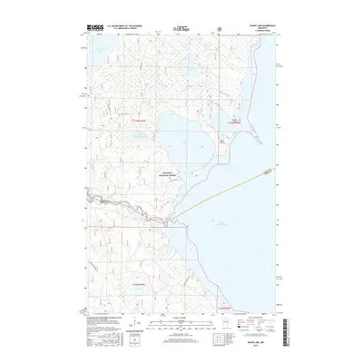
2016 Map of Raven Lake
USGS Topo · Published 2016About this map
The Chippewa National Forest dominates this northern Minnesota landscape, where the Mississippi River winds through a dense network of wetlands and glacial lakes. The river channel serves as the primary boundary between Itasca and Cass counties, feeding into the massive expanse of Lake Winnibigoshish at the southern edge of the map. This area is characterized by significant water management and forest service infrastructure, notably the Sugar Lake Impoundment and a web of forest access points like Forest Rd 2171 and 2948 Logging Rd. Local landmarks such as Sugar Island and Ravens Point break the shoreline of Sugar Lake, while smaller interior bodies like Raven Lake, Rabbits Lake, and Lake Harry provide a granular look at the region's hydrologic character within the federal timberlands.
Find a feature on this map
21 named features on this map. Tap any name to fly to it.
Don’t see what you’re looking for? This feature index may not catch every label — zoom into the map to look around manually.
Map Details
Editions of this 2016 Raven Lake Map
This is the sole edition of this map. No revisions or reprints were ever made.
Other maps of this area

1919 · Rosy
USGS Topo · 1:62,500

1919 · Max
USGS Topo · 1:62,500

1954 · Bemidji
USGS Topo · 1:250,000

1957 · Bemidji
USGS Topo · 1:250,000

1958 · Bemidji
USGS Topo · 1:250,000

1971 · Dixon Lake
USGS Topo · 1:24,000

1971 · Gimmer Lake
USGS Topo · 1:24,000

1971 · Raven Lake
USGS Topo · 1:24,000

1971 · Bena
USGS Topo · 1:24,000

1971 · Sucker Lakes
USGS Topo · 1:24,000