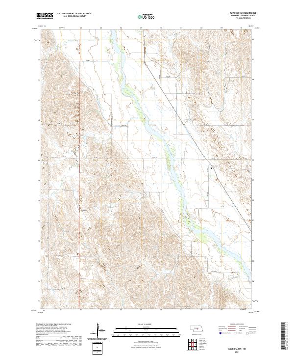
2021 Map of Ravenna NW
USGS Topo · Published 2021About this map
The Middle Loup River carves a broad valley through the center of this Sherman County landscape, defining the region's agricultural and irrigation infrastructure. The complex water management system of the early twenty-first century is evident in the paths of Canal Number 3 and Canal Number 4, which parallel the river's course to support the surrounding plains. These human-made channels intersect a network of natural drainages including Wiggle Cr, Beaver Cr, and Rock Cr.
Find a feature on this map
36 named features on this map. Tap any name to fly to it.
Don’t see what you’re looking for? This feature index may not catch every label — zoom into the map to look around manually.
Map Details
Editions of this 2021 Ravenna NW Map
This is the sole edition of this map. No revisions or reprints were ever made.
Other maps of this area

1899 · Loup
USGS Topo · 1:125,000

1951 · Arcadia SE
USGS Topo · 1:24,000

1951 · Litchfield NE
USGS Topo · 1:24,000

1951 · Hazard
USGS Topo · 1:24,000

1953 · Rockville
USGS Topo · 1:24,000

1953 · Ravenna NW
USGS Topo · 1:24,000

1953 · Loup City SE
USGS Topo · 1:24,000

1953 · Loup City
USGS Topo · 1:24,000

1953 · Ashton
USGS Topo · 1:24,000

1953 · Ravenna
USGS Topo · 1:24,000