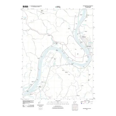
2011 Map of Ravenswood
USGS Topo · Published 2011About this map
Ohio River dominates this 2011 survey, carving a wide path past the industrial and transport hub of Ravenswood. The map documents a diverse riverfront economy, from the heavy industry of Ravenswood Works and the logistical utility of the Jackson County Airport to more traditional river features like the Ravenswood Ferry and Buffington Island. The shoreline is punctuated by numerous historic points of access, including Mill Landing, Halls Landing, and James Hall Landing, reflecting the area's long-standing connection to the waterway.
Find a feature on this map
115 named features on this map. Tap any name to fly to it.
Don’t see what you’re looking for? This feature index may not catch every label — zoom into the map to look around manually.
Map Details
Editions of this 2011 Ravenswood Map
This is the sole edition of this map. No revisions or reprints were ever made.
Other maps of this area

1906 · Belleville
USGS Topo · 1:62,500

1907 · Keno
USGS Topo · 1:62,500

1907 · Ripley
USGS Topo · 1:62,500

1908 · Ravenswood
USGS Topo · 1:62,500

1924 · Belleville
USGS Topo · 1:62,500

1926 · Ravenswood
USGS Topo · 1:62,500

1926 · Belleville
USGS Topo · 1:62,500

1926 · Ripley
USGS Topo · 1:62,500

1928 · Ravenswood
USGS Topo · 1:62,500

1928 · Ripley
USGS Topo · 1:62,500