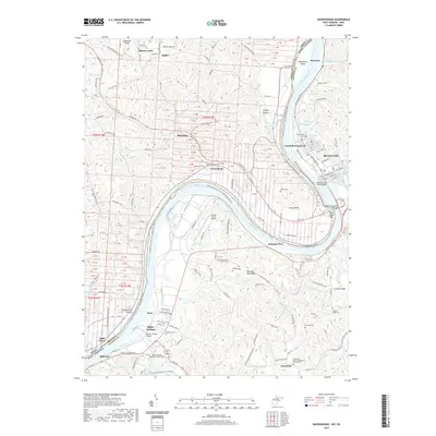
2019 Map of Ravenswood
USGS Topo · Published 2019About this map
The Ohio River carves a massive horseshoe bend through this riverfront landscape, anchoring the settlement of Ravenswood and its northern expansion at North Ravenswood. This 2019 survey captures the developed river plain where historical crossings like Ripley Landing and the Ravenswood Town Bridge once dictated the flow of commerce. The terrain rising from the banks is marked by numerous family and community burial grounds, including the Ravenswood Cemetery and McKay Cemetery, which serve as vital touchstones for local genealogy.
Find a feature on this map
223 named features on this map. Tap any name to fly to it.
Don’t see what you’re looking for? This feature index may not catch every label — zoom into the map to look around manually.
Map Details
Editions of this 2019 Ravenswood Map
This is the sole edition of this map. No revisions or reprints were ever made.
Other maps of this area

1906 · Belleville
USGS Topo · 1:62,500

1907 · Keno
USGS Topo · 1:62,500

1907 · Ripley
USGS Topo · 1:62,500

1908 · Ravenswood
USGS Topo · 1:62,500

1924 · Belleville
USGS Topo · 1:62,500

1926 · Ravenswood
USGS Topo · 1:62,500

1926 · Belleville
USGS Topo · 1:62,500

1926 · Ripley
USGS Topo · 1:62,500

1928 · Ravenswood
USGS Topo · 1:62,500

1928 · Ripley
USGS Topo · 1:62,500