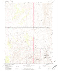
1980 Map of Rawhide
USGS Topo · Published 1983About this map
Mining heritage and vanished boomtowns characterize this survey of the desert landscape at the border of Churchill and Mineral counties. The townsite of Rawhide serves as the focal point, surrounded by a cluster of named elevations including Hooligan Hill, Grutt Hill, Balloon Hill, and Murray Hill. These peaks and the nearby National Mill represent a period of intense extraction that once drew thousands to this corner of the Nevada desert. Further north, the townsite of Regent and the Rawhide Cemetery mark the enduring traces of these early twentieth-century settlements.
Find a feature on this map
20 named features on this map. Tap any name to fly to it.
Don’t see what you’re looking for? This feature index may not catch every label — zoom into the map to look around manually.
Map Details
Editions of this 1980 Rawhide Map
2 editions found
Other maps of this area

1908 · Carson Sink
USGS Topo · 1:250,000

1909 · Hawthorne
USGS Topo · 1:250,000

1910 · Carson Sink
USGS Topo · 1:250,000

1911 · Hawthorne
USGS Topo · 1:250,000

1915 · Hawthorne
USGS Topo · 1:250,000

1948 · Walker Lake
USGS Topo · 1:250,000

1951 · Allen Springs
USGS Topo · 1:62,500

1957 · Walker Lake
USGS Topo · 1:250,000

1957 · Reno
USGS Topo · 1:250,000

1959 · Reno
USGS Topo · 1:250,000