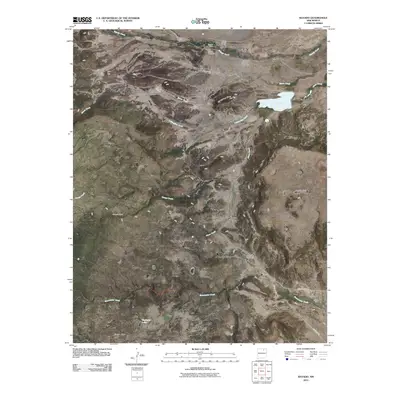
2010 Map of Rayado
USGS Topo · Published 2010About this map
The Rayado Historic District preserves a vital node of New Mexico's frontier history, where the high plains meet a series of prominent tablelands. This landscape is defined by its massive topographical features, including Kit Carson Mesa, Rayado Mesa, and Rivera Mesa, which overlook the winding paths of Rayado Creek and Sweetwater Creek. The presence of the Santa Fe Trl in the southeastern corner highlights the area's significance as a historic transit corridor.
Find a feature on this map
23 named features on this map. Tap any name to fly to it.
Don’t see what you’re looking for? This feature index may not catch every label — zoom into the map to look around manually.
Map Details
Editions of this 2010 Rayado Map
This is the sole edition of this map. No revisions or reprints were ever made.
Other maps of this area

1954 · Raton
USGS Topo · 1:250,000

1956 · Tooth Of Time
USGS Topo · 1:62,500

1956 · Miami
USGS Topo · 1:62,500

1958 · Raton
USGS Topo · 1:250,000

1966 · Mora Ranch
USGS Topo · 1:24,000

1966 · Ocate
USGS Topo · 1:24,000
1966 · Charette Lake
USGS Topo · 1:24,000

1981 · Springer
USGS Topo · 1:100,000

1983 · Taos
USGS Topo · 1:100,000
1987 · Coyote Mesa
USGS Topo · 1:24,000