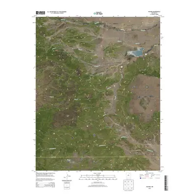
2013 Map of Rayado
USGS Topo · Published 2013About this map
Philmont Scout Ranch dominates the western portion of this high-country landscape where the plains of northeast New Mexico meet the southern Rockies. The settlement of Rayado and the nearby Abreu Cem anchor a territory defined by a series of prominent landforms, including Kit Carson Mesa, Rayado Mesa, and Ortega Mesa. These flat-topped features rise above a network of waterways like Rayado Cr and Sweetwater Cr, which have long dictated the movement of people and livestock through the region.
Find a feature on this map
54 named features on this map. Tap any name to fly to it.
Don’t see what you’re looking for? This feature index may not catch every label — zoom into the map to look around manually.
Map Details
Editions of this 2013 Rayado Map
This is the sole edition of this map. No revisions or reprints were ever made.
Other maps of this area

1954 · Raton
USGS Topo · 1:250,000

1956 · Tooth Of Time
USGS Topo · 1:62,500

1956 · Miami
USGS Topo · 1:62,500

1958 · Raton
USGS Topo · 1:250,000

1966 · Mora Ranch
USGS Topo · 1:24,000

1966 · Ocate
USGS Topo · 1:24,000
1966 · Charette Lake
USGS Topo · 1:24,000

1981 · Springer
USGS Topo · 1:100,000

1983 · Taos
USGS Topo · 1:100,000
1987 · Coyote Mesa
USGS Topo · 1:24,000