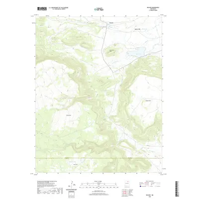
2020 Map of Rayado
USGS Topo · Published 2020About this map
Rayado and Sunny Side occupy a high-elevation landscape defined by significant drainage systems and distinct flat-topped landforms near the border of Colfax and Mora counties. The terrain is characterized by a series of mesas, including Kit Carson Mesa and Ortega Mesa, which rise above the surrounding plains. To the north, Rayado Cr flows past the Abreu Cemetery, a local landmark of genealogical importance. Water management is evident in the presence of Miami Lake, a prominent reservoir that sits below the eastern slopes of the mesas. These geographic features reflect a historical reliance on the natural watersheds of La Maquina Cr and Moras Cr for settlement and ranching in this high-desert environment. The map details a complex network of canyons and plateaus, such as Rayado Mesa, which have shaped the movement and land use of this region.
Find a feature on this map
21 named features on this map. Tap any name to fly to it.
Don’t see what you’re looking for? This feature index may not catch every label — zoom into the map to look around manually.
Map Details
Editions of this 2020 Rayado Map
This is the sole edition of this map. No revisions or reprints were ever made.
Other maps of this area

1954 · Raton
USGS Topo · 1:250,000

1956 · Tooth Of Time
USGS Topo · 1:62,500

1956 · Miami
USGS Topo · 1:62,500

1958 · Raton
USGS Topo · 1:250,000

1966 · Mora Ranch
USGS Topo · 1:24,000

1966 · Ocate
USGS Topo · 1:24,000
1966 · Charette Lake
USGS Topo · 1:24,000

1981 · Springer
USGS Topo · 1:100,000

1983 · Taos
USGS Topo · 1:100,000
1987 · Coyote Mesa
USGS Topo · 1:24,000