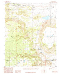
1987 Map of Rayado
USGS Topo · Published 1987About this map
Philmont Scout Ranch occupies the northern reaches of this New Mexico landscape, where the high mesa country meets historic travel corridors. The map documents a transition from the elevated plateaus of Kit Carson Mesa and Rayado Mesa down toward the drainage of Rayado Creek. Central to the geography is the Beaubien and Miranda (Maxwell) grant, a massive tract of land that shaped settlement patterns in this part of Colfax County. Evidence of the region’s ranching and scout heritage is visible through sites like Rayado Camp, Sweetwater Cow Camp, and the tiny settlement of Rayado.
Find a feature on this map
24 named features on this map. Tap any name to fly to it.
Don’t see what you’re looking for? This feature index may not catch every label — zoom into the map to look around manually.
Map Details
Editions of this 1987 Rayado Map
This is the sole edition of this map. No revisions or reprints were ever made.
Other maps of this area

1954 · Raton
USGS Topo · 1:250,000

1956 · Tooth Of Time
USGS Topo · 1:62,500

1956 · Miami
USGS Topo · 1:62,500

1958 · Raton
USGS Topo · 1:250,000

1966 · Mora Ranch
USGS Topo · 1:24,000

1966 · Ocate
USGS Topo · 1:24,000
1966 · Charette Lake
USGS Topo · 1:24,000

1981 · Springer
USGS Topo · 1:100,000

1983 · Taos
USGS Topo · 1:100,000
1987 · Coyote Mesa
USGS Topo · 1:24,000