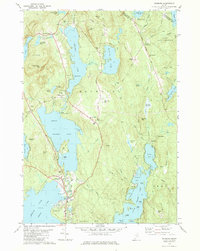
1981 Map of Raymond
USGS Topo · Published 1981About this map
Sebago Lake dominates the southern landscape of this 1981 survey, where the waters of Jordan Bay meet the shoreline at Browns Point. The region is defined by a dense network of glacial lakes and ponds, including the large Panther Pond and Crescent Lake, which are connected by the Tenny River. This aquatic geography supported a mid-century recreational economy evident in features like the Hinds Boy Scout Camp and several campgrounds.
Find a feature on this map
89 named features on this map. Tap any name to fly to it.
Don’t see what you’re looking for? This feature index may not catch every label — zoom into the map to look around manually.
Map Details
Editions of this 1981 Raymond Map
3 editions found
Other maps of this area

1894 · Gray
USGS Topo · 1:62,500

1896 · Norway
USGS Topo · 1:62,500

1896 · Sebago
USGS Topo · 1:62,500

1898 · Gray
USGS Topo · 1:62,500

1908 · Poland
USGS Topo · 1:62,500

1940 · Poland
USGS Topo · 1:62,500

1942 · Poland
USGS Topo · 1:62,500

1942 · Gray
USGS Topo · 1:62,500

1942 · Sebago Lake
USGS Topo · 1:62,500

1943 · Sebago Lake
USGS Topo · 1:62,500