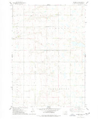
1973 Map of Raymond SE
USGS Topo · Published 1978About this map
The prairie landscape of Clark County is defined by its township grid and subtle watercourses in the early 1970s. This survey area is divided between the townships of Logan, Lincoln, Fordham, and Darlington, illustrating the organized agricultural expansion of the region. Foster Creek meanders through the western sections, while a network of rural roads connects the scattered farmsteads and civic landmarks. For local historians, the Townhall in the southeast and the Darlington Cem serve as key anchor points for the community's social and ancestral geography. The presence of a Well, a Gravel Pit, and Radio Towers suggests a landscape balancing traditional farming with mid-century infrastructure and resource extraction.
Find a feature on this map
10 named features on this map. Tap any name to fly to it.
Don’t see what you’re looking for? This feature index may not catch every label — zoom into the map to look around manually.
Map Details
Editions of this 1973 Raymond SE Map
This is the sole edition of this map. No revisions or reprints were ever made.
Other maps of this area

1953 · Watertown
USGS Topo · 1:250,000

1958 · Watertown
USGS Topo · 1:250,000
1973 · Baileys Lake
USGS Topo · 1:24,000
1973 · Raymond
USGS Topo · 1:24,000

1973 · Willow Lake
USGS Topo · 1:24,000

1973 · Clark South
USGS Topo · 1:24,000
1973 · Clark North
USGS Topo · 1:24,000
1973 · Carpenter
USGS Topo · 1:24,000
1973 · Carpenter NE
USGS Topo · 1:24,000
1973 · Fordham Dam
USGS Topo · 1:24,000