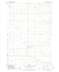
1973 Map of Raymond
USGS Topo · Published 1978About this map
Raymond serves as a focal point in this portion of the Glacial Lake Agassiz plain, where the Chicago and North Western railroad cuts a straight path across the flat prairie. The landscape is defined by its agricultural regularity, marked by a dense network of section lines and fence rows that separate the townships of Ash, Raymond, Spring, Richfield, and Logan. Evidence of the area's rural social structure is visible in the placement of the Prairie Valley Cem and St Patricks Cem, alongside modern infrastructure like the Landing Strip and Sewage Disposal Ponds. The border between Spink and Clark Counties bisects the western edge of the sheet, illustrating how political boundaries overlay the physical terrain. Small-scale resource extraction is noted at a Gravel Pit, while a Roadside Park in the southeast provides a rare public space in this largely private agricultural expanse.
Find a feature on this map
20 named features on this map. Tap any name to fly to it.
Don’t see what you’re looking for? This feature index may not catch every label — zoom into the map to look around manually.
Map Details
Editions of this 1973 Raymond Map
This is the sole edition of this map. No revisions or reprints were ever made.
Other maps of this area

1894 · Conde
USGS Topo · 1:62,500

1895 · Byron
USGS Topo · 1:125,000

1895 · Aberdeen
USGS Topo · 1:125,000

1953 · Milbank
USGS Topo · 1:250,000

1953 · Huron
USGS Topo · 1:250,000

1953 · Watertown
USGS Topo · 1:250,000

1954 · Aberdeen
USGS Topo · 1:250,000

1954 · Huron
USGS Topo · 1:250,000

1956 · Aberdeen
USGS Topo · 1:250,000

1958 · Milbank
USGS Topo · 1:250,000