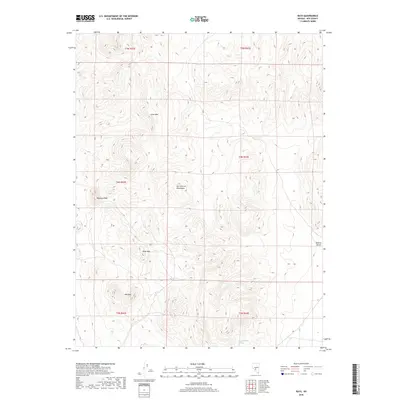
2018 Map of Rays
USGS Topo · Published 2018About this map
The San Antonio Mountains dominate this central Nevada landscape, providing a high-elevation contrast to the arid expanse of the Ralston Desert to the east. Located in a region defined by its volcanic geology and mining history, the map depicts the isolated settlement of Rays, situated on the western slopes near Rhyolite Peak. This area in Nye County showcases a classic Basin and Range profile, where several distinct summits including Lime Mtn, Black Mtn, and Red Mtn rise sharply above the desert floor. Water is a rare and critical resource here, marked by the presence of Slaughterhouse Spring in the southern reaches of the quadrangle. The survey illustrates the stark topographical relief and the sparse network of tracks that connect these high-desert landmarks.
Find a feature on this map
14 named features on this map. Tap any name to fly to it.
Don’t see what you’re looking for? This feature index may not catch every label — zoom into the map to look around manually.
Map Details
Editions of this 2018 Rays Map
This is the sole edition of this map. No revisions or reprints were ever made.
Other maps of this area

1907 · Tonopah
USGS Topo · 1:250,000

1908 · Tonopah
USGS Topo · 1:250,000

1956 · Tonopah
USGS Topo · 1:250,000

1959 · Tonopah
USGS Topo · 1:250,000
1960 · Tonopah
USGS Topo · 1:24,000

1961 · Tonopah
USGS Topo · 1:62,500

1961 · Lone Mtn
USGS Topo · 1:62,500

1962 · Tonopah
USGS Topo · 1:250,000

1963 · Baxter Spring
USGS Topo · 1:62,500

1964 · San Antonio Ranch
USGS Topo · 1:62,500