1957 Map of Rayville
USGS Topo · Published 1958About this map
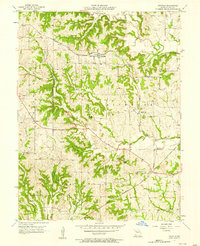
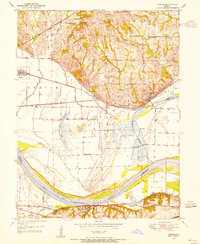
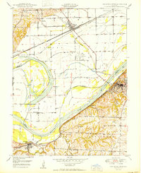
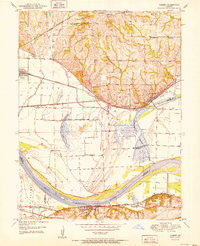
Rayville sits at the intersection of rural transit and agriculture in this mid-century Missouri landscape, where the Atchison Topeka and Santa Fe railroad cuts across the northern terrain. The area is defined by the winding paths of the West Fork Crooked River and Crooked River, which dictate the placement of small communities like Swanwick and St Cloud. Numerous small family cemeteries and rural schoolhouses are scattered across the quadrangle, indicating a well-established, decentralized farming community before the major consolidation of the late 20th century.
Find a feature on this map
33 named features on this map. Tap any name to fly to it.
Don’t see what you’re looking for? This feature index may not catch every label — zoom into the map to look around manually.
Map Details
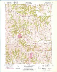
Editions of this 1957 Rayville Map
2 editions found
Other maps of this area

1889 · Lexington
USGS Topo · 1:125,000

1894 · Independence
USGS Topo · 1:125,000
1935 · Buckner
USGS Topo · 1:24,000
1949 · Lexington West
USGS Topo · 1:24,000

1950 · Kansas City
USGS Topo · 1:250,000
1950 · Camden
USGS Topo · 1:24,000
1950 · Lexington West
USGS Topo · 1:24,000
1951 · Camden
USGS Topo · 1:24,000

1953 · Moberly
USGS Topo · 1:250,000

1954 · Kansas City
USGS Topo · 1:250,000