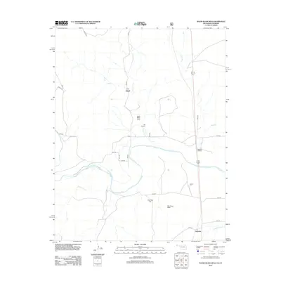
2012 Map of Razor Blade Mesa
USGS Topo · Published 2012About this map
The Cimarron River meanders through this high plains borderland, carving a distinct hydrological pattern across the arid terrain of Oklahoma and Colorado. Near the settlement of Castaneda, the landscape is defined by dramatic topographical rises such as Razor Blade Mesa and Sugarloaf Mtn. This 2012 survey illustrates the relationship between these prominent mesas and the intricate network of drainage canyons, including Aubrey Canyon and Ute Canyon. Local history is anchored by the Garrett Cem, a vital point for genealogists tracing early residents of Cimarron County. The interplay between the river and its tributaries, like Cold Springs Cr and Flagg Springs Cr, reveals the essential water sources that dictated ranching and land use patterns in this high-altitude environment. A network of rural routes, including n0277 RD and e0050, connects these isolated geographical features across the state line.
Find a feature on this map
29 named features on this map. Tap any name to fly to it.
Don’t see what you’re looking for? This feature index may not catch every label — zoom into the map to look around manually.
Map Details
Editions of this 2012 Razor Blade Mesa Map
This is the sole edition of this map. No revisions or reprints were ever made.
Other maps of this area

1891 · Springfield
USGS Topo · 1:125,000

1892 · Vilas
USGS Topo · 1:125,000

1893 · Springfield
USGS Topo · 1:125,000

1954 · Dalhart
USGS Topo · 1:250,000

1955 · La Junta
USGS Topo · 1:250,000

1958 · La Junta
USGS Topo · 1:250,000

1958 · Dalhart
USGS Topo · 1:250,000

1962 · Dalhart
USGS Topo · 1:250,000

1968 · La Junta
USGS Topo · 1:250,000

1968 · Autograph Cliff NW
USGS Topo · 1:24,000